Muck Maps reveals the areas most polluted by factory farms for the first time, as an interactive map. The research finds that up to 33,450 tonnes of manure is produced in the UK every day by chickens and pigs in factory farms. The Severn, Great Ouse, Ouse (Yorkshire), Trent, Norfolk Rivers Group and the Wye top the list of river catchments being polluted by factory farms.
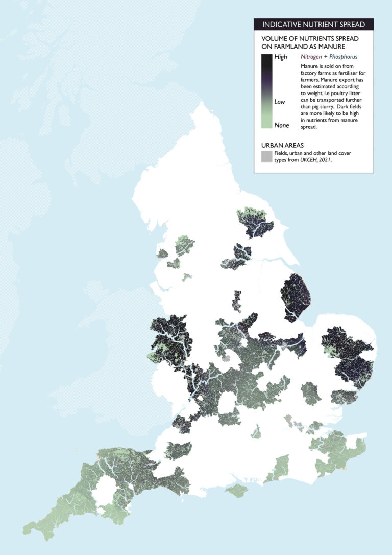
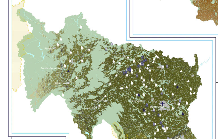
Muck Maps reveals the areas of the UK that are most at risk of nutrient pollution from manure produced in factory farms. Materiality researched muck spread, mapped this using GIS, and created an interactive tool for Sustain, Compassion In World Farming and Friends of the Earth. The darker areas of the map indicate where muck is spread at the highest quantities. Three additional maps present the volume of manure produced by factory farms per Local Planning Authority, Westminster Constituency, and main river catchment.
Muck is excreted by poultry and pigs, removed when the animals are sent to slaughter, and is mostly exported to farmers to be used as fertiliser. While this adds nutrients to the soil, most soils in the UK are in a nutrient surplus and cannot absorb the volume of manure being spread. Manure can run off oversaturated soil into local rivers, either directly or slowly through soil – especially if the manure is spread before a rain event. The nutrients from manure can cause algal growth in rivers, leading to algal blooms that starve plants of light and fish of oxygen, creating dead zones. Manure from factory farming also carries disease risks, and nutrient pollution from manure prevents housebuilding from taking place. Research we published earlier this year indicates where the dominant meat agribusinesses operate in relation to major rivers across the UK.
Livestock farms that have more than 40,000 birds or 2,000 pigs are classed as intensive and require an environmental permit. These farms are recorded by DEFRA.The farm locations and livestock capacity data were used in combination with an authoritative map of farmland to indicate where factory farm muck could be spread. The probability of muck being spread was calculated from average distances that muck is exported to farmers, combined with the volume of muck produced by each factory farm. The darker brown areas are more likely to be spread with muck, and at higher volumes. The volume of manure produced by each factory farm and the overlap between export areas determines the muck spread colour gradient.
Research produced for Sustain, Compassion In World Farming, and Friends of the Earth.
Published by Sustain, Compassion In World Farming, and Friends of the Earth.
Reported by The Independent, The Mirror, the BBC, the Belfast Telegraph, The Scotsman, ENDS Report, Wicked Leeks and The Grocer.


